 LANDSCAPE AND ENVIRONMENT
Introduction | Research | People | Tools
LANDSCAPE AND ENVIRONMENT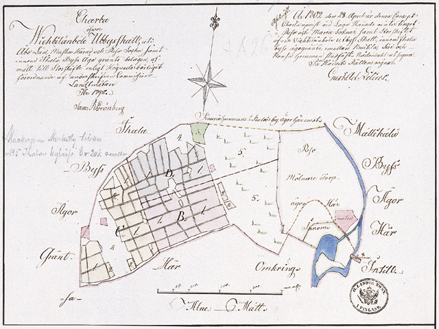
Maanmittaushallituksen arkisto A: 90 Raisio 5/6.
1803 - VIHTILÄNPYÖLI MAP
Sami Raninen
Vihtilänpyöli was a taxable outlying agricultural area, a separate piece of land which was cultivated by the inhabitants of Ihala village after 1584, having been before that property of Kajala farm of Kuloinen village. Vihtilänpyöli was perhaps a remainder of a farm that had become desolated in the Middle Ages and the lands had been taken into use by neighbouring farms. In 1803 Vihtilänpyöli was divided between Knuuti (Nuutila) and Siiri farms and a croft. The map shows the fields of the area both in open field system and general parcelling. East of the fields there was a hill covered by forest which was in the general parcelling owned partly by Knuutila and partly by the croft (N° 5 on the map). On the other side of the hill there were the miller's croft and the big water mill of Huhkonkoski Rapids on the opposite bank of Raisionjoki River.
Introduction | Research | People | Tools