 LANDSCAPE AND ENVIRONMENT
Introduction | Research | People | Tools
LANDSCAPE AND ENVIRONMENT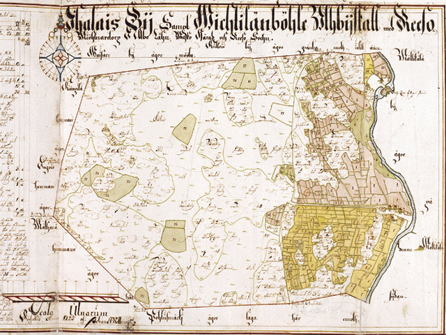
Maanmittaushallituksen arkisto A: 90.
1725 - IHALA VILLAGE MAP
Sami Raninen
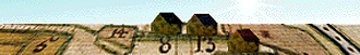
The numbers 1-7 stand for village fields which have been divided by an «open field system». Number 8 represents the Konsa farms, 13 Siiri, 18 Knuuti (Nuutila), and 24 Mulli farm, and 34-36 stand for the windmills of Konsa, Knuuti and Mulli, respectively. The Huhkonkoski Rapids water mill is also mentioned on the map (Reeso Qwarn). Numbers 31-33 mean the miller's croft and croft fields, and 29-30 stand for Vihtilänpyöli parcels. Up, between the fields is written Linnasmäki.
Introduction | Research | People | Tools